


johnvanvliet
just some thoughts
by , 11-30-2014 at 09:47 PM (17162 Views)
--- need to add images still ---
being in i would say a small subsection of the Big " Maps and Cartography" category
the " photo realistic " area
i tend to work with imaging data from spacecraft and hence tend to not want labels and grid lines and compasses on the image
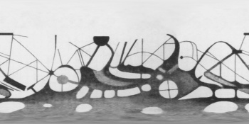
although this is not from photographic images of Mars
but a charcoal sketch map from looking through a telescope
( looking through old images and this was for a OLD project that was canceled )
preprinted blank maps pages were used
Like this 1894 map by: Leo Brenner
http://planetologia.elte.hu/ipcd/leobrenner1.jpg
that poses a few problems if one wants to software render that map ON a sphere
--- that part is for different forums on said 3d software
but what ever is being used from PIXAR's "Renderman" to Pov-ray to Crystal-Space to ... anything
The normal format for the final product is a power of 2 image in Simple Cylindrical projection
so the first issue
it is a photo from a book , and is distorted
i use only open-source software so NO PHOTOSHOP
The Gimp has a nice perspective tool that can be used to straiten ought the image in the link
other tools can do things like that also and to the extreme one could make a "control network" of points for the ISIS3 program "warp " to un distort the image
The next issue is it is NOT 90north to 90 south
But inverted and 70 south ( top) to 50 North ( bottom)
and in mercator projection ( GREAT if you are in a boat on the ocean )
http://en.wikipedia.org/wiki/List_of_map_projections
now the grid lines on the first image will need to be removed ( new ones can be added latter if one wants)
and the labels and numbered locations
For that i use the gimp plugin "resynthesizer"
http://www.logarithmic.net/pfh/resynthesizer
http://www.logarithmic.net/pfh/resynthesizer/removal
-- current source
https://github.com/bootchk/resynthesizer
95% of the time this tool dose a good job ,every now and then the fix will need fixing
Now i use a very specialized tool most of the time "isis3"
and as the saying goes " if you are a hammer EVERYTHING then is a nail"
So i use the GIS software ISIS3
http://isis.astrogeology.usgs.gov/index.html
but any GIS program that uses GDAL and proj4 , or even the terminal and use the bash interface and type in the code to warp the image will do.
now once the image is fully 90 N to -90 S you can also remap a part of the map to JUST the southpole area
then use resynthesizer to "fix" the pole
--- this tool should be a blog post all on it's own
Tags:
None

- Categories
- Guides - for 3d

