I created this 3D fantasy globe (see images at bottom of post) a few years ago and wanted to share its story and some images with everyone.
I apologize if construction details are not typically put into this forum, but this is a finished project at this time.
History:
I was playing in a Dungeons & Dragons campaign in Massachusetts with a great DM. Certainly the best DM I ever had the pleasure to game with. Steve (the DM) had some general maps of his game world and everything was great, at least until the day I decided to move to Virginia.
While in Virginia I was playing in another D&D campaign with a new DM that had a very interesting globe of his world. I had never seen or considered such a device for a game and was really impressed. He had painted his land masses onto a small (maybe 2” diameter) wooden sphere from a hobby/fabric store.
This was a great idea and I decided that I'd make one of these up for Steve, but I’d make it bigger, with 3D terrain. I also figured that using all of the tools in the prototype shop would not hurt either!
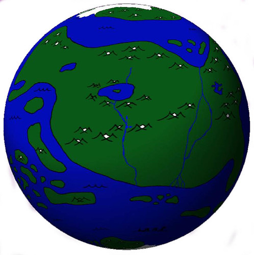
I called up Steve and had him FAX me the world map he was using for his campaign. I received this sketch that required a little bit of cleanup before I could get started.
I started the project off by finding a wooden sphere to use as my globe. I had considered using a bowling bowl as it would have been a great size, but the weight was ridiculous. I thought about buying a small globe at the store, but most of those were cardboard and I wanted something better, longer lasting.
I finally settled on a 4” cedar sphere that I found at an online woodworking site.
The next step was to model up the sphere in some CAD software. I’ve used SolidWorks for years, so that was the logical choice. Once the sphere was modeled I could wrap/render the original Faxed drawing onto the sphere and then “trace” around the continents in the software so I could turn them into solid little islands on the surface of the sphere. Almost like continental plates floating around!
If you have not considered it, I would really suggest wrapping the 2D maps you draw around a sphere and seeing how they look. I know there are many different projection types and many of the maps on this site are not “meant” to be wrapped, but it really gives a different perspective to the map and the distances between and the sizes of the landmasses.
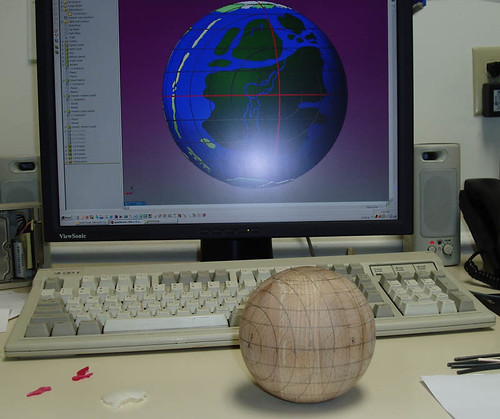
Here you’ll see an image of the CAD software along with the wooden sphere. In the CAD model I have added lines of longitude and latitude. I then drew similar lines onto the wooden sphere to help me get the continents in their correct position.
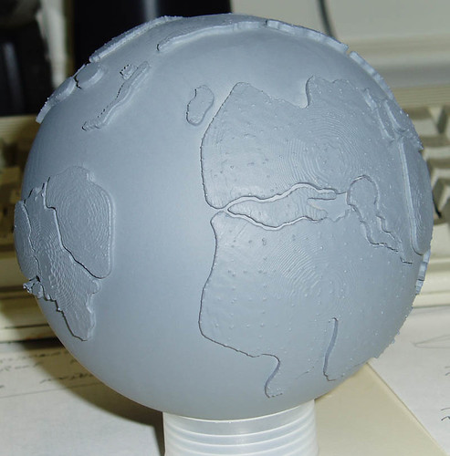
In the photo above you’ll see some of the continents in the lower left corner of the image. I exported the continents from the CAD model and built plastic versions of them on a stereolithography machine. This was pretty handy as I could make the continents with the correct curvature to match the globe.
All I had to do after the parts were built was keep track of them (there were about 50-80 pieces), and bond them to the sphere in the correct location.
The longitude and latitude lines really helped out here! The pieces were bonded in place with a simple five minute epoxy.
Once all of the parts were attached and had cured I applied a few coats of gray primer to seal up the wooden sphere.
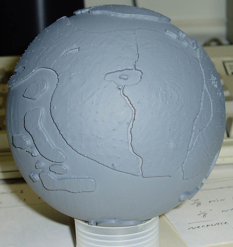
The “contour lines” and “stubble” in the above images are a result of the stereolithography process and were removed though some light sanding.
Once the model was smooth I applied a base coat of blue paint. This pretty much formed the oceans.
In the photo above you’ll also notice some texture. I did this to mark the mountain ranges on the model in the locations where they existed in the drawing. I just painted the mountains onto the part using some thinned out glazing putty.
I experimented with airbrushing the continents to give then some color but I didn’t like the results and ultimately decided it would be best to let Steve paint the model since he would have a better idea of the terrain features.
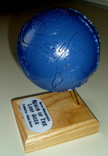
The model was then mounted on a wooden base with a brass axis of rotation:
Some additional images are:
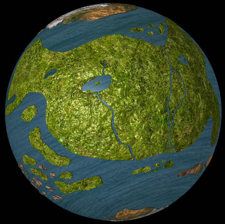
A test of some rending of textures and colors on the CAD data:
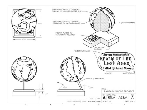
A drawing showing some additional details and construction notes:
The model was a lot of fun to build and I’ll likely make up a larger scale globe for myself once I find a world map that I’d like to use in future campaigns. Just today I happened upon an un-drilled ten-pin bowling ball that would make a heavy, but unique globe...




 Reply With Quote


