Page 1 of 4 1234 LastLast
Results 1 to 10 of 32

Thread: WIP Middle-Earth

Hybrid View

Previous Post Previous Post   Next Post Next Post
  1. #1

    Default WIP Middle-Earth

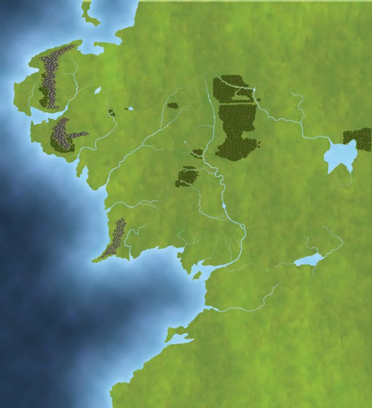
    I've decided to make a map of Tolkien's Middle Earth. A little ambitous, I know . I wanted to try out the colourfull style of my last map some more, and since I love Tolkien's woks, decided to give it a try.

    It's going to be quite huge, since the massive amount of names which have to fit on it . I'm using an original version of Tolkien as base.

    So far, I've only got the land & sea colours, the rivers and the forest (there actually not a lot of them, I'd never noticed before...)
    Next are the mountains.

    WIP ME.jpg
    Last edited by RobA; 12-16-2010 at 12:23 AM.

  2. #2
    Professional Artist Guild Donor Sapiento's Avatar
    Join Date
    Jul 2009
    Location
    Salzburg, Austria
    Posts
    3,655

    Default

    Good start! Some of the rivers could be refined (the transition from thinner to broader parts seems a little bit abrupt in some places), some parts of them are covered by forest.

  3. #3
    Guild Journeyer hohum's Avatar
    Join Date
    May 2009
    Location
    Phoenix, AZ
    Posts
    166
    Blog Entries
    3

    Default

    Looks good. I like the watercolor effect of the land and the tree color variation is very nice. Are you using your own brushes?

  4. #4

    Default

    I refined the rivers (it's things like this that make my wish I had a tablet ) and redid the forests. The trees are a bit bigger, and they don't cover the rivers anymore.
    Some of the other 'gaps' in the forests are meant for roads & mountains.

    @Hohum; I used Ramah's tree brushes as a base, the colouring & shading is my own. (I did use his TreeThing application to create the forests, It's a bit difficult to get the open spaces for the rivers in the right place, but it beats putting the trees in one by one ).
    Attached Images Attached Images

  5. #5
    Administrator Redrobes's Avatar
    Join Date
    Dec 2007
    Location
    England
    Posts
    7,244
    Blog Entries
    8

    Default

    Hi Saule, I am part of a little group which makes a big version of ME map as well. In one of our challenges we finished off one version of it which you can find here:
    http://www.cartographersguild.com/sh...y-Middle-Earth

    It will be interesting to see yours progress.

  6. #6

  7. #7
    Community Leader Facebook Connected Steel General's Avatar
    Join Date
    Jun 2008
    Location
    Ft. Wayne, IN
    Posts
    9,530

    Default

    Progressing quite nicely.
    My Finished Maps | My Challenge Maps | Still poking around occasionally...

    Unless otherwise stated by me in the post, all work is licensed under a Creative Commons Attribution-Noncommercial 3.0 United States License.


  8. #8
    Guild Applicant
    Join Date
    Dec 2010
    Location
    Hollywood, Florida
    Posts
    1

    Default

    Hi Saule,
    I know what you mean by "huge". My original map (started in Illustrator) was 200 in x 200 in. I finished it in InDesign with thoughts of publishing it as an "interactive" map with bookmarks. The final result was dictated by computer hardware & software limitations for my targeted output. The map in now an iPad app (see the images in my gallery — if interested). I am currently working on the Second Age where the "Fall of Beleriand" and the rise of Númenor are shown. The map is available on the iTunes App Store...
    http://itunes.apple.com/us/app/middl...408301883?mt=8
    Last edited by richardblum; 12-18-2010 at 07:52 AM. Reason: The image URL wasn't working

  9. #9

    Default

    Thanks for all the comments . It's been a while since I've worked on this. I'd started on the mountains, and found out there are actually quite a lot of them. Because my method of creating mountain basically consists of copy-pasting all the individual mountain pictures in place, I realised it was going to be a lot of work. I actually tried using Ramah's tree-thing for the mountains, but they came out too small. I didn't really feel like working on it for a while because the task seemed endless, but I've started again. 2 mountain ranges are now in place. I'm hoping to be able to start copy-pasting groups of mountains more and more as I get on, hopefully not having to put in every single thing by hand . (The lowest mountain range was how it would've come out if I'd used the tree thing for the mountains...)
    For some reason the forum is not letting me upload the file, so here's a picture with a link to my DA gallery. The 'Download' butten at the right will give you the original size... (Does anyone know why I'd get a 'not a valid image file' error for a .jpg? )


  10. #10

    Default

    Looks good so far Saule, and it's good to see you back at the Guild again! Hm, I'm not sure about the error message, I would guess it had something to do with the size of the image, but then that wouldn't explain the "not a valid file" message. Shrug.

    Cheers,
    -Arsheesh

Page 1 of 4 1234 LastLast

Tags for this Thread

Posting Permissions

  • You may not post new threads
  • You may not post replies
  • You may not post attachments
  • You may not edit your posts
  •