Page 1 of 3 123 LastLast
Results 1 to 10 of 22

Thread: 3D Atlas of Barsaive [Earthdawn] using Unreal3/UDK

Hybrid View

Previous Post Previous Post   Next Post Next Post
  1. #1
    Guild Apprentice Telarus's Avatar
    Join Date
    Jul 2008
    Location
    Oregon
    Posts
    31

    Default 3D Atlas of Barsaive [Earthdawn] using Unreal3/UDK

    Hi everybody.

    I've been lurking around here a while (see my intro thread) and wanted to thank you all for being such a fantastic resource.

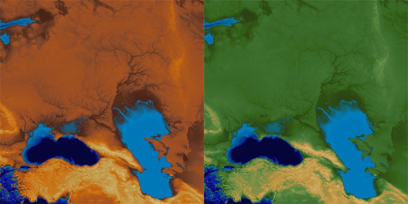
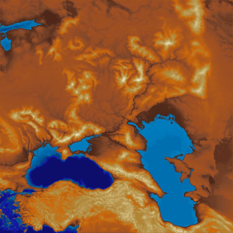
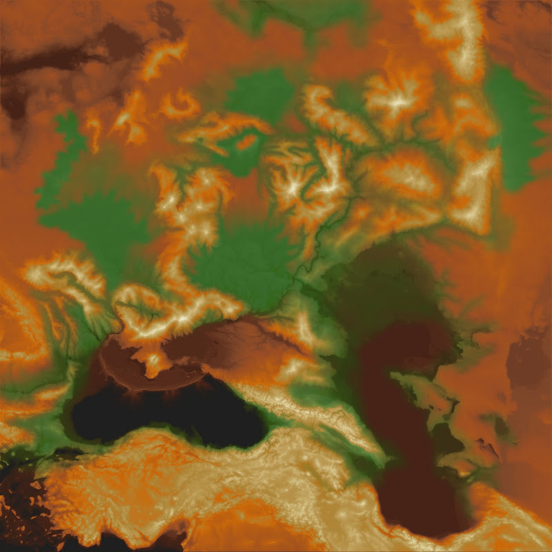
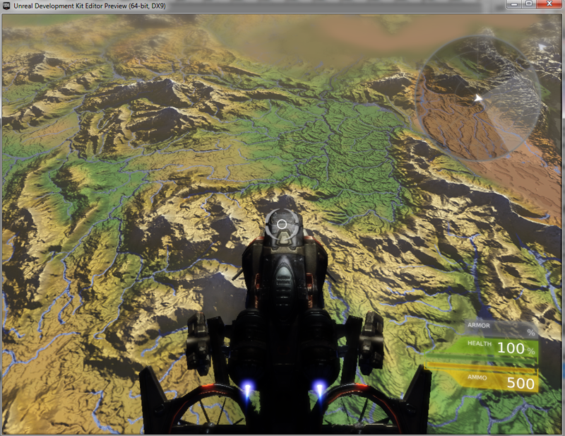
    So here's some work-in-progress screenshots from my current project. This project was based on 1km satellite DEM data, and shows the world of Barsaive (roughly analogous to the Volga river basin/Black sea/Caspian sea areas), with 8+ additional major landforms/mountain-ranges added, and lots of fine detail work to get the fantasy river systems to make sense with the irl data.

    It also draws pretty heavily on Tom Patterson's ideas about cartography (he runs shadedrelief.com). Specifically "crossblended hypsomertic tints" and ideas about displaying terrain forms to an observer. Thanks Tom!

    I haven't added the river textures/specularity yet, or the water surfaces (which will hopefully be animated), and there are no name/place markers yet. Here are some shots of the last few weeks of work.

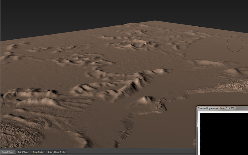
    - Rough edit of new landform placement onto DEM data, stock hypsometric tints, edited hypsometric tints showing the new landforms, a crossblended hypso, and some shots of the final 3d object rendered in the UDK (NOT TO SCALE!).


    In-Editor Shot 01: On the left we have the volcano known as "Mt Bloodfire" and the lava shelf of Death's Sea. Behind Mt Bloodfire stands the Twighlight Peaks, with the Tylon Mts further in the distance. On the horizon just up from the gun-sight are the Throalic Mts, home of the powerful Dwarf Kingdom of Throal.

    In Editor Shot 02: Same location from a higher altitude, looking west towards the Ork Kingdom of Cara Fahd (just up from the gun-sight) and the Theran (roughly a high-magic roman-empire analog) controlled territory of Vivane & Sky Point (upper left of the image).

    I'm having problems building my lighting at the moment, but I plan to add in a sky dome and some distance haze for the first-person version. I'll also be setting up a top-down view, which I can then render out as a large image mosaic for use in MapTool or another Virtual Tabletop.
    Last edited by Telarus; 05-23-2011 at 04:49 AM.

  2. #2
    Administrator Redrobes's Avatar
    Join Date
    Dec 2007
    Location
    England
    Posts
    7,245
    Blog Entries
    8

    Default

    This looks very interesting. I will keep an eye on your thread to see the latest developments.

  3. #3
    Guild Apprentice Facebook Connected SilenBlade's Avatar
    Join Date
    May 2011
    Location
    A, A
    Posts
    43

    Default

    Good Job Mate! Keed Doing!

  4. #4

    Default

    Giving the amount of airships and dragons flying around in earthdawn, this seems like a great idea.

  5. #5
    Guild Apprentice Telarus's Avatar
    Join Date
    Jul 2008
    Location
    Oregon
    Posts
    31

    Default

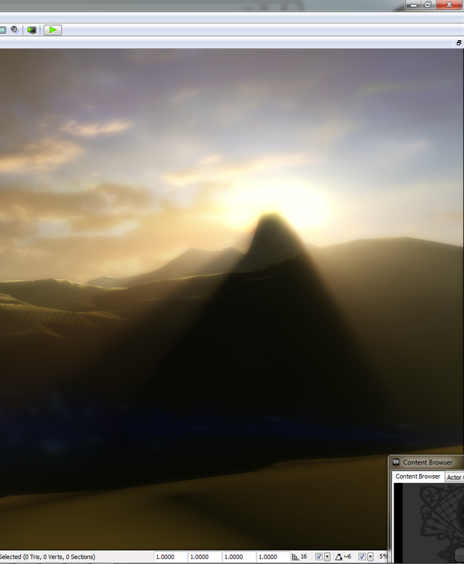
    Well, it's not a huge update (I'm working on texture "splatting" before a final shadow-map build), but here's a shot of one of the Named Peaks showing my sun & sky setup, with "light shafts", an atmospheric perspective heightfog, and depth-of-field blurring. You can also see a hint of the specular highlights (which move in real time) on the river in front of the camera.

    So, I'm working on getting final textures (rock, grasslands, forest canpoy, swamp/mud) and details onto the terrain, and building the Markers that I'm going to be marking Named Places with.


  6. #6
    Administrator Redrobes's Avatar
    Join Date
    Dec 2007
    Location
    England
    Posts
    7,245
    Blog Entries
    8

    Default

    Can you explain what is going on in that second shot. Is it that in the distance there is a mountain and this is casting a shadow towards the camera ? It looks a bit odd tho. I think the shadow is too severe. If the mountain were so far away then the maximum depth of shadow would be that of the grey tint that the mountains to the left of it are producing since they must also be in shadow too. Are you able to set the blackness of the god rays shadow based on the distance to the shadow inducing terrain ? The lighting on those mountains to the left looks great tho.

  7. #7
    Guild Apprentice Telarus's Avatar
    Join Date
    Jul 2008
    Location
    Oregon
    Posts
    31

    Default

    Ah, yes, lining up a peak silhouette with the sun probably wouldn't be a good idea IRL (OUCH!). This was an extreme example (the pics were to answer a question on another forum). Here is another series of shots showing those effects, and how the total final effect changes depending on elevation and thus view angle:


    The extreme shadowing in the last shot is an example of the Unreal3 engine 'compensating' for not being able to actually achieve the real light intensity from the sun, so the engine fakes what your eye would do when confronting that situation, by simulating the sensory contrast effects that happen with physical light. Real-time engines these days, right?

  8. #8
    Guild Apprentice Telarus's Avatar
    Join Date
    Jul 2008
    Location
    Oregon
    Posts
    31

    Default

    Sometimes I don't know what do do with myself while I wait for something to render. For example, this current a rain simulation cycle I'm in the middle of takes 2 hours to draw the river valleys so I know where to paint rocky ridges, and where to paint lush valleys (where the Horror blight isn't). Not to mention the 4+ previous hours spent doing iteration after iteration of 30 minute 'low resolution' Rain cycles, tweaking, doing another, tweaking, until I found the right settings for the full 2 hr simulation.

    Fortunately, that means I've time for a few more screenshots! Again, click for full size.

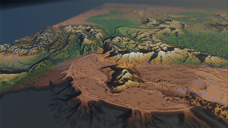
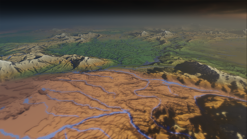
    Some _extremely_ high altitude "dragon's eye views" of Barsaive. The last one has some notes on where I'm probably going to put Bartertown/Throal and the actual distance scale used (which I noted earlier will probably be tweaked for ED travel times). I want the engine to eventually output the distance between two points in purely ED travel times and rough KM/Miles distances. But that's going to wait on the art side a bit.


    Last edited by Telarus; 06-07-2011 at 05:02 AM.

  9. #9
    Guild Apprentice Telarus's Avatar
    Join Date
    Jul 2008
    Location
    Oregon
    Posts
    31

    Default

    Note: Everything looks mch more "daylight" than the first shots and the shadows are doing a lot of the work filling in the colors (notice the color saturation differences from the previous shots). This allows the blue rivers (and their white highlights) to 'pop' visually. Shots are from above the Tylon Mts, looking towards Throal and over the Servos Jungle towards Lake Ban.

  10. #10

Page 1 of 3 123 LastLast

Posting Permissions

  • You may not post new threads
  • You may not post replies
  • You may not post attachments
  • You may not edit your posts
  •