Results 1 to 9 of 9

Thread: City of Saskatoon

Hybrid View

Previous Post Previous Post   Next Post Next Post
  1. #1
    Guild Novice
    Join Date
    Mar 2020
    Location
    Saskatchewan Canada
    Posts
    10

    Map City of Saskatoon

    This was the final Project for my cartography course back when I was in school. It was an attempt at a vintage map of a nearby city. There's a lot of things I would have done differently for this project now. Perhaps one day I'll try to do this again for my current city but with with different techniques.

    This map started out in arcmap where I did the majority of the symbology and updated some of the data to add roads and other missing information.
    I exported it as an image and brought it into photoshop to add texture and flair. as well as clean up some of the junctions that weren't drawing properly.
    The final Photoshop file was grossly huge and very difficult to work with. (Several GB) I reduced the resolution for viewing on the internet.

    city_of_saskatoon_by_miss_story_d7eknkd-fullview.jpg
    This is a snip of the map before road labels had been applied and had different faded filters on top of it.
    Zoom Example No Lbls.png

    If anyone's interested in some of the techniques I used or what I'd probably do now I'd be happy to explain.

  2. #2
    Guild Master Falconius's Avatar
    Join Date
    Jul 2013
    Location
    Israel
    Posts
    2,733

    Default

    That's pretty cool.

    It makes me realize just how much water can just be sitting around on the ground, at least in the prairies. Maybe it's because they are the brightest areas on your map. I'll have to be more careful to think about that in the future.

  3. #3
    Guild Novice
    Join Date
    Mar 2020
    Location
    Saskatchewan Canada
    Posts
    10

    Default

    Yes, I haven't really thought about it much but there are tonnes of small wetlands and sloughs scattered throughout the plains especially during wet years. I'll keep that in mind next time I work on any fantasy maps with prairies.

    The yellow is a bit bright. This was when I was deep in the 'everything is a muddy yellow brown in my maps' stage of life. Which I suppose has it place but I should have definitely used some more contrast.

    I think If I were to do this again I'd probably do up some building footprints in a darker tone to make the city pop properly.

    edit: And probably a larger scale that focuses on a specific area so cleanup doesn't take me a million years.

    edit 2: The wetlands are usually potholes and kettles in the landscape that were left over from the last glacial period so not all plains are so wet, just a fun fact for map building
    Last edited by Flawed-Menagerie; 11-19-2020 at 07:15 PM.

  4. #4
    Guild Master Josiah VE's Avatar
    Join Date
    Feb 2016
    Location
    Winnipeg, Manitoba, Canada
    Posts
    2,099

    Default

    This is really beautiful. Never been, but when I drive to western Manitoba I see signs for it 600 km away.
    For a while I've kind of wanted to get into artistic maps of real world places, I think what you've done is brilliant. A perfect blend of the artistic and useful aspects of a map.
    Regarding the prairies and water, where I come from we don't have nearly as much water lying around in kettles and potholes, as you move west they seem to become more common. Probably has to do with where the glacier was and presence of a glacial lake.

    I offer map commissions for RPG's, world-building, and books
    PORFOLIO | INSTAGRAM

  5. #5
    Guild Master Falconius's Avatar
    Join Date
    Jul 2013
    Location
    Israel
    Posts
    2,733

    Default

    Quote Originally Posted by Josiah VE View Post
    where I come from we don't have nearly as much water lying around in kettles and potholes, as you move west they seem to become more common
    Really? I would've thought the other way around, Manitoba is filled with lakes, ponds, rivers, and creeks. Maybe its a north south thing instead. Hmm, looking at the map it looks like it's actually a NE SW thing...

  6. #6
    Guild Master Josiah VE's Avatar
    Join Date
    Feb 2016
    Location
    Winnipeg, Manitoba, Canada
    Posts
    2,099

    Default

    Quote Originally Posted by Falconius View Post
    Really? I would've thought the other way around, Manitoba is filled with lakes, ponds, rivers, and creeks. Maybe its a north south thing instead. Hmm, looking at the map it looks like it's actually a NE SW thing...
    Okay, Manitoba does have 100,000 lakes, so there is a lot of water standing around, but most of those are in the north. In the spring everything does get pretty swampy because our soil is like clay and it doesn't really drain and the city is in a floodplain.
    In terms of potholes, I'm wondering if it could be that there aren't too many around Winnipeg because there used to be a massive postglacial lake here, flattened out the terrain a bit?

    I offer map commissions for RPG's, world-building, and books
    PORFOLIO | INSTAGRAM

  7. #7
    Guild Novice
    Join Date
    Mar 2020
    Location
    Saskatchewan Canada
    Posts
    10

    Default

    I agree Alberta is gorgeous it has such a diverse landscape. Everything from mountains, exposed canadian shield, badlands, prairies, foothills as well as part of the cypress hills that have pretty old rock because they're like this elevated 'island' area that missed out on getting carved away by ice/water. Super unique bit of landscape.

    Yes Lake... Agassiz was massive. I think its actually possible to visit and see the old shoreline of that lake.
    I Imagine that it would have made a huge difference to general topology in the region, especially when everything drained out of it. It would probably have smoothed out a bunch of the uneven mixture that got dumped by the glaciers that form the little baby lakes and sloughs that litter the landscape.

    I often get stuck up on big things like plate tectonics when thinking about topography/geology also to a lesser extent I'll consider water erosion in a world but in northern regions the effects of glaciers thousands of years ago can effect things so much. wind erosion is something I overlook too. we have quite a few cases of sand dunes here that have since been colonized/stabilized by plants that form undulating gentle hills that are now mostly pine forests. (Because of their good drainage and lack of nutrients). I don't know why but I'm really inspired to refine some of my fantasy world maps with this in mind.

    As for Saskatoon itself its a really pretty city. The bridges at its core are very unique aside from the very utilitarian ones that have been built much more recently. I do enjoy visiting there. I have been stuck there myself a couple times due to snow storms.

  8. #8
    Professional Artist Tiana's Avatar
    Join Date
    Oct 2009
    Location
    Winnipeg, Manitoba, Canada!
    Posts
    1,825

    Default

    Quote Originally Posted by Flawed-Menagerie View Post
    Yes Lake... Agassiz was massive. I think its actually possible to visit and see the old shoreline of that lake.
    That is correct! You will see a distinct 'climbing out of the lake' going through the national park and also a transitional point somewhere around Morden, and of course, a transitional point as you head through the Whiteshell towards Kenora and into Ontario, entering the Canadian Shield, which is also visually fascinating. One thing I always take into account in my worldbuilding is glacial activity. XD Of course it's very topical living in the basin of Lake Agassiz. I've spent wayy too much time thinking about Lake Agassiz. Saskatchewan is interesting too, of course, with its near desolate fields caused from over-logging there are places that are the very picture of open space, exposed to the enormous sky. And the mining of Potash as a major product... it's actually the most significant source of potash, a major fertilizer, in the world.

    I have been stuck there myself a couple times due to snow storms.
    You know you're really Canadian when you've been literally 'stuck' somewhere due to snow. I got stuck in Saskatoon, and I got stuck in Morris once, that's how you know I'm really living in Manitoba. T_T This is a real risk with rural Canadian travelling. Sometimes you have no choice but to stay where you are until the storm stops and the plows make it through.

    I love taking in mind Canada when I map, it's so popular to do European inspired mapping...

    Tectonics are good too, of course.

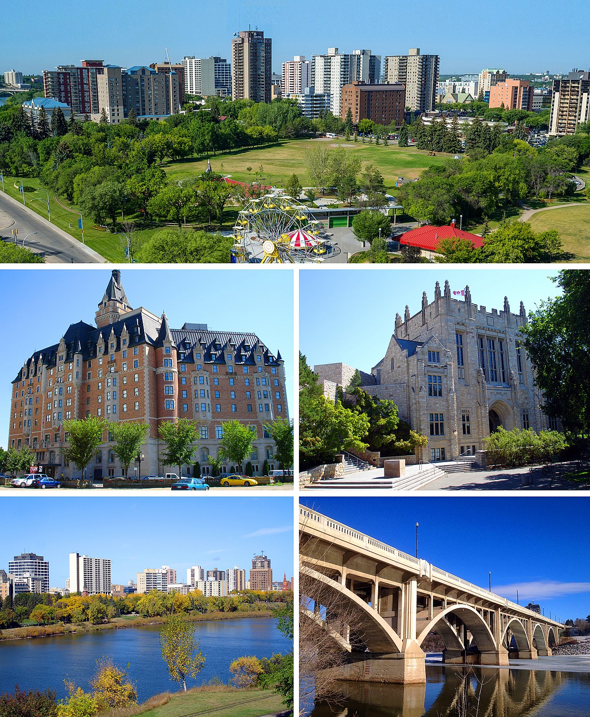
    Saskatoon picture from Wikipedia for context.

    Click my banner, behold my art! Fantasy maps for Dungeons and Dragons, RPGS, novels.
    No obligation, free quotes. I also make custom PC / NPC / monster tokens.
    Contact me: calthyechild@gmail.com or _ti_ (Discord) to discuss a map!


  9. #9
    Professional Artist Tiana's Avatar
    Join Date
    Oct 2009
    Location
    Winnipeg, Manitoba, Canada!
    Posts
    1,825

    Default

    Hi, yes, I live in Manitoba and also have lived in Alberta so I've been back and forth a lot, and there's definitely a lot more standing water once you get into Alberta compared to around Winnipeg. I agree there are many lakes, ponds, rivers, and creeks in Manitoba, but it's this specific sort of... ditches filling up and whatnot that you see a lot more often in the West. Just slight terrain differences, I really like the sight of the standing water ponds and ditches but the swampiness can be a real mess too. I remember one time I got stuck because it iced up a hill where the water had been melting down, in just the wrong way that I slid down into a ditch and had to jump to reach a tree and haul myself out, heh.

    Anyway, some parts of Manitoba are intentionally drained otherwise it definitely would have more issues with flooding. It's less of a problem in Alberta because of the foothills to fill. I love Alberta's aestetic. So beautiful.

    Saskatoon is nice too though. I've been there several times. I even got stuck there once.

    Click my banner, behold my art! Fantasy maps for Dungeons and Dragons, RPGS, novels.
    No obligation, free quotes. I also make custom PC / NPC / monster tokens.
    Contact me: calthyechild@gmail.com or _ti_ (Discord) to discuss a map!


Tags for this Thread

Posting Permissions

  • You may not post new threads
  • You may not post replies
  • You may not post attachments
  • You may not edit your posts
  •