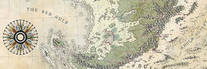
Hello fellow cartographers!
After posting this map... and realising that it was far less coherent in style (and pleasing to the eye) than this one, which was drawn much earlier (and which represents the same place, but on a larger scale), I went back to the drawing board.
I don't think I'll ever have spent so much time on a map, but this one is close to my heart because of the story behind it. So I've rethought the whole layout: this is a map that should be used to instruct newly crowned monarchs about the different parts of their kingdom, the duchies, the main Houses, the major towns and villages. So I designed it as a sort of booklet, which folds up and closes over the map of the Kingdom. On the advice of several of you, I've reworked the look of the elements outside the map, so that they don't distract from the representation of the island, taking advantage of the old, worn look.
I think I've ended up with something fairly coherent... I hope you like it!
Royaume Duyin Guild.jpg


 Reply With Quote

 ).
).


 !
!


