Hi fellow cartographers!
I'm sorry I haven't been very active in the guild lately, so I'll start making it up for it bu posting some of my latest works.
Back in 2016 I was commissioned to work on a pretty amazing book project called Från Döda fallet till Ales stenar – Platser med (spök)historia (From The Dead Fall to Ale’s stones – places with a (ghost)story), written by Lena Arro and published by Opal. It is an intriguing mix of fiction, folklore, horror and history, as it takes the reader into a North-to-South journey across Sweden, visiting 9 remarkable locations and their historical and supernatural legacy.
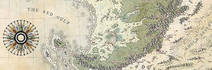
Luckily enough, I also got to create some maps for it, most notably the double-page opening full color overview of Sweden/Scandinavia with highlights on the different places explored in the text.
If you are interested in knowing more about the project, or see some of the other illustrations I made for the book, please check out this post on my website.
EDIT: The big map is ink on paper, then colored digitally. The small ones are pencil on paper.
FDFTAS_00B_map.jpg TLMM_web_HEADER_02.jpg
FDFTAS_08_kullaberg_B_01.jpg FDFTAS_09_karlbergs-slott_B-01.jpg FDFTAS_02_falu-koppargruva_B-01.jpg
FDFTAS_01_ales-stenar_B-02.jpg FDFTAS_99_jätte-trollkast_B-01.jpg FDFTAS_04_döda-fallet_B-01.jpg


 Reply With Quote


