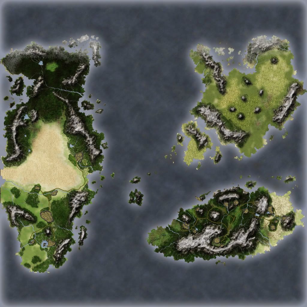
Well! I am restarting the work on Kurond! Here is the base Image I have to work with:
Uploaded with ImageShack.us
Well! I am restarting the work on Kurond! Here is the base Image I have to work with:
Uploaded with ImageShack.us
Uh oh, broken pic is broken!
I fixed it!
Unless your map is a frog in an ice cube, I don't think it's fixed...
Oh.. I'm sorry.. It appears fine on mine. But here you can use this http://img703.imageshack.us/img703/3...continents.png
After a couple days of working experimenting and finding Textures im proud to present a base of the Kurond map. I have currently only done the Human Kingdoms and roads as I have not figured out how to do the other races.
Ps: This map is for a member of my RolePlay clan.
Ps: Ps: Use this to help me find If I did anything wrong.
"The lower half, or human kingdoms is mildly foresty on the east side, and on west it's open plains. The terrain of Rathengar used to be a deadly corrupted land, only one spot of that corrupted land remains. On the West side of it is thinned out forests, being very thin near the ocean border slightly getting thicker as you move east, but then starts to thin out again as you reach the start of the words of the first picture i gave you. As for Rathengar, there is a huge circular mountain "border" surrounding the city (with enough room for three farm towns, and quite a bit of open plains, though Rathengar itself should still be quite big.) there is one "secret" river in to the northern side of the mountains, this land is corrupted and is the only remaining corrupted land, the river is surrounded by forests and cannot be seen, it leads to a lake east of Rathengar, (not very east, a mile or two) The entrance and exit of the river should be hidden from view. The entrance to the mountainous border is south east. There is only one. As for the very north of the continent that Rathengar is on, the terrain is VERY mountain-y, but only on the very ocean border. The very east side is a rejuvenated desert, has the terrain of a desert but no sand, and what I mean by that is that he has lots of those sand mounds (but instead of sand it's now dirt and grass.) As for the Goblin kingdoms, the whole place is deforested, there are several factories (weapons (no guns yet) and small machines mostly.) Also, the ocean to the west of the Human + Elven kingdoms is much larger than the ocean inbetween the goblin kingdoms, the kingdoms of chaos (now human owned) and the Human + Elven kingdoms. So Humans would not travel west to reach Rathengar. Also I have decided on names for each continent. The goblins are Grek't Lothor (It's Gret language for "Land of the Superiorly Intelligent" (Superiorly Intelligent is what Gret means in their language)). The Continent Rathengar is on is Called Khrim, I think I had decided that in my first post. Now the biggest one is going to be split into two names, Lati'Gromar (Ancient language for "Nature Keepers", that's the northern part) and the southern part is Lati'Grimar (Ancient language for "Nature Killers", as humans were often seen has careless with nature by the gods, before they disappeared.)"
Please do not refrain from giving me C&C.

I just got back home and should start working on it soon.


I can't make out much without a larger size but from what I can see I'd say it looks just fine.
If the radiance of a thousand suns was to burst at once into the sky, that would be like the splendor of the Mighty One...I am become Death, the Shatterer of worlds.
-J. Robert Oppenheimer (father of the atom bomb) alluding to The Bhagavad Gita (Chapter 11, Verse 32)
My Maps ~ My Brushes ~ My Tutorials ~ My Challenge Maps
I'm sorry, about the low size.
It looks fantastic to me! Awesome, actually. Higher res would be nice, though.
However, it looks like the land is really, really small if those are cities. That big city in the western continent looks a few hours walk from its neighbors, for example. Is that true?