Originally Posted by
Hai-Etlik

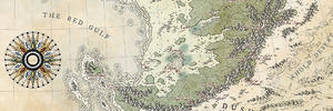
Based on the shapes of your parallels, this appears to be a conic projection, but this does not seem to match up with your description of the size of the extent and the curvatures and spacing of the parallels. The only way it might, maybe make any sense is if the planet is VERY small, quite cold, and with very low axial tilt. I'm pretty sure those two solutions would conflict with each other though.
Think about it this way, the contiguous US doesn't come anywhere near EITHER the equator or the arctic circle so a map that contains both needs to be much bigger than the contiguous US on a planet that is even remotely Earthlike. Also the arctic circle should be closer to the edge of the map than to the equator unless you are doing something VERY strange with the projection. You could have a permafrost line south of the equator if your planet is very cold with a narrow band of habitable temperatures at the equator, but you would not use this conic projection centred up in the frozen wastes like this if that were the case.
Just looking at the features of the map, it feels like an even smaller area than the contiguous US, which would make all the problems worse.
If you're getting started, I'd suggest you stick with something close to Earth in terms of size, axial tilt, and climate. Then pick a region on Earth as a template in terms of size, latitude, and general climate. Then decide what your map is for. Once you have extent and purpose, you can pick an appropriate projection. For starting out, smaller is better. The smaller the area you are working with, the less you have to worry about projecting a sphere onto a flat map and the problems it causes. An island can be a good start.


This is my attempt to learn about cartography and photoshop at the same time. I'm still completely new with both and willing to hear suggestions on all fronts.

 Reply With Quote