Hello everyone!
My name is happyyasu09 and I have a group of people who are making an RPG game (not paid T_T) but very interesting in idea and lore and story itself.
We tried hard to make a map that would have two key features: 1)Realistic geodata 2)Fantasy assets (mountains, islands etc), but we FAILED T_T
So we are open to pay (price is opened for discussion via pm's or skype-conference) for a map with the details provided below.
[Terrestial body]
[Tech Description Worldmachine]
Colormode: Greyscale 16-bit PNG Non-interlaced (0-256 colorcode), with all layers (snow, vegetation, desert etc) exported as png-mask (for later to use in WorldPainter)
Dimensions: 70,000x40,000 (WxH), this is comfortable dimensions, but could be bigger, can't be smaller.
Software: WorldMachine (similar software)
WorldMachine Specific Dimensions: 70x40 km, highest point 2560 meters, water level at 650 meters. All the layer: eg. snow, desert, clay, should be exported at full scale as png-mask (black-white)
[Tech Description Photoshop]
Colormode: Greyscale 16-bit PNG Non-interlaced (0-256 colorcode)
Dimensions: 70,000x40,000 (WxH), this is comfortable dimensions, but could be bigger, can't be smaller.
Software: Photoshop/Illustrator (similar software), WM better.
[How should it look like]
North pole on top, South pole on bottom. Seamless option only for East/West hemispheres!
Have one huge continent + one smaller continent for which we will give you a greyscale, which need to be redone to make it use the same water level as the whole world (seabed at 1, shore starts at 65).
This is rough of how should continents be placed
worldmechanics.png
Lightgreen goes for main continent (twice as big as greyscale), greyscale of second continent at 8,000x7,000 pixels.
Darkgreen goes for cold landmass, not so huge in sizes, less rivers, more hilly (natural geodata), gray area for mountain range (top is 256), white is ice shield, so making it more "flat" would be good.
Blue between White and Darkgreen on the bottom of image is for ice walls, like South pole has.
This is how north and south landmass should end
^9734E5DE6F7A0C8660A90073764D160978B8BD349B55930F19^pimgpsh_mobile_save_distr.jpg
So not just cut out the landmass. It's better to add 512px to top and bottom as borders. So on the image that 512 pixels would be after the mountain got really high.
Cold\Hot Sketch
i2^pimgpsh_mobile_save_distr.jpg
This is really rough sketch of how does equator goes through map, it shouldn't go straight from left to right, some diagonals should be good, also if you could add a "theoretical" hot ocean stream, so you can make more realistic hot/cold division it would be better.
[Special Requests]
This section is for special assets that are in the lore and in ideas forms, that we really want to see on the map.
- Table Mountain - some kind of table mountain in a desert area would be good. Making smaller variants of it everywhere in desert would be better.
- Island-Fortress - some kind of man made huge island which is really close to continent. Not like super huge but huge enough.
- A crater - north pole has Crater, which unlink mountain range, and makes somewhat like natural gates to icy part of the world.
- The Edge of World mountain range - the top mountains should not be just plain mountains, they should be really higher than any other mountains, they should really look like edge of the world. Place some terraces and plains down from them so we would built cities near them.
- The Zoenar - massive voclano on north part of the main continent. We need that almost as high as a EoW mountains.
- The Delta - something like Amazon river delta or Nile river delta for a capitol of one of the kingdoms.
- The Akka Bay - something like Istanbul bay, would be good to have a really small island just in the center of the bay.
[Some more images]
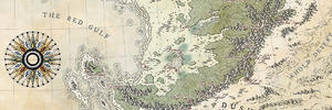
This is our previous map, its really unrealistic in shape, so we didn't like it T_T
NEWMAP.jpg
This is sketch of an island that we want to see on the map
Elder's Island infra.png
Elder's Island marks.png
This places also should have some space on a map somewhat in the middle of continent (on any of 4 of them).
Copper's River CIty Plan.jpg
Capitolzonage.png
There are two more maps that we need, smaller than first one, if you would like to do them too, we will discuss the details upon interest, as we are still preparing info for it.
There is much of the time, as we are sorting out all the lore and stories we have, and doing other text stuff. So you have really up to 6-7 month before, we will start to need a map, even after that time, we will still have some more tasks to do.
Copyrights and other stuff
We can use it in our game, lore, wikia and website.
Author has any rights to post it anywhere on his portfolio, devianart, imgur, photobucket (but the dimension should be lesser than we need, we just don't want anyone to get an image for free and use it anywhere they want).
We wont resell it, but we can make some profit from game itself (mostly opened donations, nothing strict)
We would also like if you could make a timelapse of major parts of your work, so we could see the progress and post it as dev.blog posts, with all the links the author wants in the description section of the post.
Thank in advance! Have a good day!)


 Reply With Quote


 , especially when you deal with potential client.