Page 1 of 3 123 LastLast
Results 1 to 10 of 29

Thread: Battling topography: Brywaeo!

Hybrid View

Previous Post Previous Post   Next Post Next Post
  1. #1
    Guild Expert Facebook Connected Caenwyr's Avatar
    Join Date
    Apr 2012
    Location
    Flanders, Belgium
    Posts
    1,276

    Default Battling topography: Brywaeo!

    Hey guys!

    With my Krastvin map done and published, and me still waiting for my client to secure the necessary funds for the last part of my multi-map commission (more on that one later), I decided to try my hand at yet another type of map I haven't done before. All this in the spirit of learning the ropes (and in the process, if all goes right, adding some nice little maps to my portfolio, of course!).

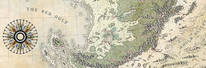
    The style I'm going for is the topographic map you find in so many school atlases, think this map for example. Although my end product will probably look vastly different (and a lot less awesome).

    Okay! So as usual I started out by creating the land masses:
    Brywaeo (1).jpg

    I then drew in sketchy mountain ridges and rivers:
    Brywaeo (2).jpg

    Which I then used to draw a first, very preliminary contour line. This one is probably gonna delineate something of a "mean" height (with many more contour lines in the red area than there will be in the white area):
    Brywaeo (3).jpg

    Before I continue, do you guys see anything glaringly wrong with this single contour line that should definitely be taken care of? I can't see anything over-obvious at this stage, but many know more than one, especially if that one has been with his face all the way up to the screen during the creation.

    So yell, scream, bellow if you see anything that shouldn't be there .
    Attached Images Attached Images
    Caenwyr Cartography


    Check out my portfolio!

  2. #2
    Guild Expert Facebook Connected Caenwyr's Avatar
    Join Date
    Apr 2012
    Location
    Flanders, Belgium
    Posts
    1,276

    Default

    Okay, so I got some work done on the map, and I feel like I'm progressing quite nicely. There's still a ton of tweaks to be performed and I am sort of considering to pull the entire thing through Wilbur again for realism's sake... but I believe I can say it's beginning to look somewhat acceptable.

    ### Latest WIP ###
    Brywaeo (4).jpg

    Still to be done before I can call the relief finished:
    1. I'm currently working on an extra layer just above the lowest elevation layer to smooth out the transition a little better;
    2. I also plan to rework the layer above that (currently the second layer) because I feel it cuts a little too deeply, resulting in slopes that are far too steep for that kind of elevation;
    3. I also need to add at least two, maybe even three more elevation layers in the highest regions to really get those edgy mountains going;
    4. and once all that's done, and I'm happy with the way it looks (at least in the pre-Wilbur stage), I plan to start working on the bathymetrics.


    So that's it for now guys. What do you think?
    Caenwyr Cartography


    Check out my portfolio!

  3. #3
    Guild Expert Facebook Connected Caenwyr's Avatar
    Join Date
    Apr 2012
    Location
    Flanders, Belgium
    Posts
    1,276

    Default

    Alright. I spent a few hours last night working on the map, and managed to add an intermediate layer just above the lowest contour line, rework the layer above that to smooth out the slopes on that elevation level a little bit, and add two more layers to the mountain peaks. Now that I look at it, I might need one more in just a handful of spots for a really peaky appearance!

    I also reworked the coastline to display more of the tiny islands I had in my original hand-drawn layer (the current one is a stroked path based on a selection of an 800% version of the original coastline... I thought my computer would crash on that monstrosity!). It was silly work and the difference is barely visible, but every little detail helps convey the "reality" of the place.

    Then I got down to the hardest work. Starting in the southernmost tip of the landmass, I began detailing the terrain to an almost ridiculous level. It's slow work, but oddly satisfying at the same time. So! The image above will show you two things:
    1. in the north you'll see what I did with the intermediate layer and the coastline.
    2. in the south you'll see my progress in detailing the terrain to absolute ridiculousness.


    ### Latest WIP ###
    Brywaeo (6).jpg

    The question now is: Will Wilbur be able to keep the detail, yet remove the stepped relief? If so, I'm willing to consider it. My fear is the level of vertical detail is coarser than my horizontal detail, in which case (my untrained mind thinks) Wilbur won't be able to smooth out the one without entirely wiping out the other...
    Caenwyr Cartography


    Check out my portfolio!

  4. #4
    Guild Master Facebook Connected - JO -'s Avatar
    Join Date
    May 2016
    Location
    Geneva, Switzerland
    Posts
    2,880

    Default

    I think it looks good ! I like the logic of your tectonic plates and the way you express them with mountains : the relief of the whole island seems really interesting and rich in beautiful places... Looking now at this map, it draw a land that I sure would like to discover ! It's a good mix between valley, mountains and "flat" land... So, I'm not helping you a lot, but I don't really see what would be wrong with your map right now..

  5. #5
    Guild Journeyer Facebook Connected ranger's Avatar
    Join Date
    May 2012
    Location
    Wyoming
    Posts
    112

    Default

    Very nice.
    I am enjoying watching your progress as im working on something similar myself. Though I cant get wilbur to do what I want so im having to do mine by hand

  6. #6

    Default

    The only difference I see right now between the Scotland example you linked to, and the map you have drawn, is that the Scotland map has the kind of detail you will probably create anyway with Wilbur, and a bit of very subtle relief shading.

    Looking great already

  7. #7
    Guild Expert Facebook Connected Caenwyr's Avatar
    Join Date
    Apr 2012
    Location
    Flanders, Belgium
    Posts
    1,276

    Default

    Quote Originally Posted by - JO - View Post
    I think it looks good ! I like the logic of your tectonic plates and the way you express them with mountains : the relief of the whole island seems really interesting and rich in beautiful places... Looking now at this map, it draw a land that I sure would like to discover ! It's a good mix between valley, mountains and "flat" land... So, I'm not helping you a lot, but I don't really see what would be wrong with your map right now..
    Oh no no, you ARE helping me along! The fact that it's not looking terribly wrong is in itself a reassurance. So thanks for that!

    Quote Originally Posted by ranger View Post
    Very nice.
    I am enjoying watching your progress as im working on something similar myself. Though I cant get wilbur to do what I want so im having to do mine by hand
    Well, as a matter of fact, I'm starting to consider the idea to do the whole thing by hand as well. I'm sort of a control freak, and if I decide a river should go that way, I won't just let Wilbur lead it in the other direction. So I find myself detailing my map to the point where Wilbur's contribution would probably be minimal (that is to say: the detail I'm currently putting into it is finer than the vertical steps, so Wilbur wouldn't be able to erase those without undoing all my detailing work... or so I think, I'm not exactly a Wilbur specialist either).

    Quote Originally Posted by Mouse View Post
    The only difference I see right now between the Scotland example you linked to, and the map you have drawn, is that the Scotland map has the kind of detail you will probably create anyway with Wilbur, and a bit of very subtle relief shading.
    Hey Mouse, thanks for that input! Like I wrote above, I'm actually not entirely sure anymore I will indeed use Wilbur. I know that I should, but I'm afraid it's gonna take me a humongous amount of time to actually get it to do exactly what I want, while I could just do it by hand. I know I know, that's backwards thinking but there you go.
    About the shading: I do intend to get that going as well by creating a DEM file from the different layers and using that to render a bump map. We'll see how that goes. It's quite possible I'll run into the steps of the relief after all, in which case I won't have another option than to run the thing through Wilbur anyway. It's either that or doing the entire shading process by hand. And that might just be a little too much.

    I should be able to handle Wilbur a little better after my previous map, but I'm still a bit apprehensive. It's like approaching a lion that's supposed to be anesthetized. You're sure it's safe, but still .
    Caenwyr Cartography


    Check out my portfolio!

  8. #8
    Guild Expert
    Join Date
    Jan 2016
    Location
    Canada
    Posts
    1,499

    Default

    Looks good Caenwyr, I'm working on a topographic map similar to this right now so it will be interesting to see what type of results you get from Wilbur.

  9. #9
    Professional Artist ThomasR's Avatar
    Join Date
    Nov 2015
    Location
    Angers, France
    Posts
    4,199

    Default

    That is magnificent ! It looks like the reliefs you usually display on your fantasy maps (pointy, pointy mountains) but in real life ! Kudos for that !

  10. #10
    Guild Expert Facebook Connected Caenwyr's Avatar
    Join Date
    Apr 2012
    Location
    Flanders, Belgium
    Posts
    1,276

    Default

    Alright, an incremental update for you guys: slowly working my way northward

    ### Latest WIP ###
    Brywaeo (8).jpg
    Caenwyr Cartography


    Check out my portfolio!

Page 1 of 3 123 LastLast

Posting Permissions

  • You may not post new threads
  • You may not post replies
  • You may not post attachments
  • You may not edit your posts
  •