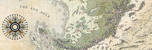
I've been running a D&D campaign for 6-12 months so far, and we've mainly been in a small region within the world.
However, things are about to become a lot bigger and I want to have a nice world map to move around in.
This will have a fair amount of artistic freedom.
The West half is where all the civilization is. The center of that within a valley is the Paldershire Kingdom with it's capitol city of Peynol.
Peynol is a trading hub of civilisation but is mainly populated by humans.
To the south is Gharngrim, the Dwarven city under the mountains. On top of the mountains in the same mountain ranges are tribes of giants.
To the north of the Paldershire Kingdom is A big Elven Forest, in the center of this forest is the great High Elf city of Selendaar. Throughout the forest are smaller tribes and villages of wood elves.
A portion of the forest has recently been destroyed by a blast of magical energy destroying everything within a large radius around it. This land is now blackened and decayed, and draws horrible creatures to it with the dark energy that infests the place. This is known as the Blasted Lands.
Above the Eleven forest there are orcish tribes and raiders, then the ocean.
To the West of the Paldershire Kingdom over the mountains is a great Desert, within this desert is the Great Dragonborn Kingdom of Arkhosia.
The Eastern half of the continent is fairly untamed, mainly populated by nomadic tribes, it is more wild, there is very little civilization. In the north East tip of the continent, is frost bitten and makes me think of vikings.
There are some small islands to the South East of the continent.
You have a fair amount of creative freedom here, especially in the Eastern Half of the Continent, as I just have no idea what to really put there and I'm not particularly great with geography.
I love the map style of a sketch book, black and white, mainly achieving greatness with many lines and shading.
Ideally would like to be able to print it at A4 and in Poster Size.
If you are interested, let me know and I can send you through all the maps I've made of the world (Region, villages, World) to get an idea of locations.


 Reply With Quote


