Hey All,
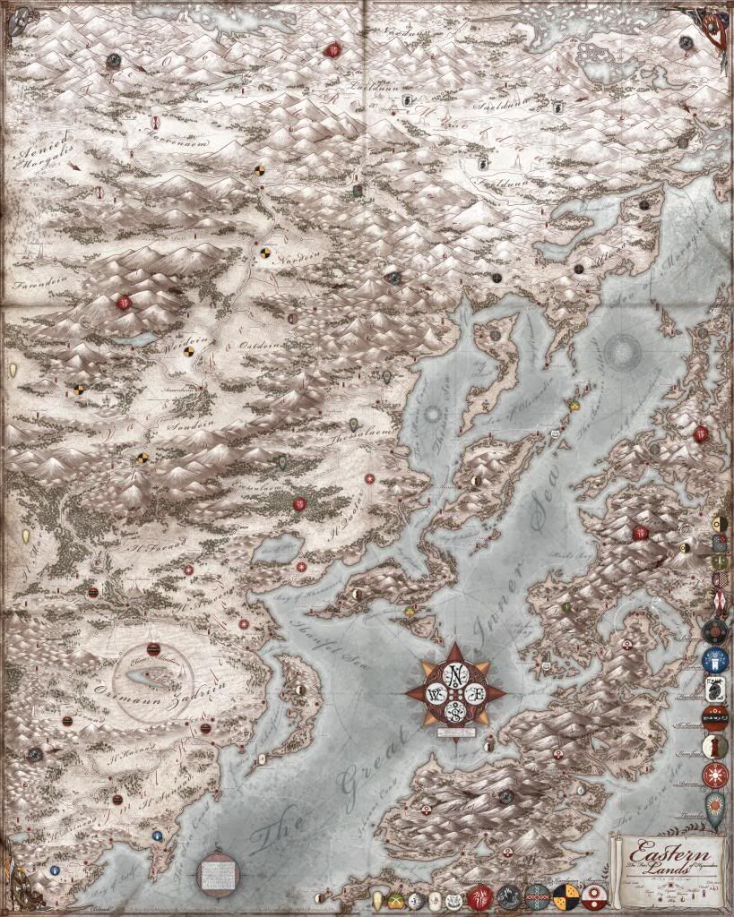
I haven't posted for a while since i've been extremely busy with work, both personal and professional. However, for GenCon this year, i have recently finished my second map of Hyranden, this time of the East. I had a blast with this one, and it will be my showpiece for the show, so if you are coming please come by and pick one up! They are 24x30 Inches, so quite largeThe map is Extremely detailed, but unfortunately i can't really fit it up here in it full glory.
*REVISED FINAL UPDATE 11/24/2013*
The World
The Eastern lands are just that: The Eastern kingdoms of Hyranden. I wanted a good mix of cultures and kingdoms, and didn't want to just throw them in there, though there are a few factions from the first that make a minor appearance. Al' Kadesh is a large Turkish-esque faction in the south centered around their Capital city in the middle of the desert. Their allies lie to the north which are the militant Aracen who have only recently converted, which has brought them into conflict with the Thessaleans, who are a dacian-esque people who live in the Northern foothills. Across the mountains are the Karingian, who are a frankish-esqu people who are uniting under a single Chieftain and establishing a firm rule of the huge valley they are in. They hail from the north, and had originally fled the growing menace of the Morankaar and Shadowkin. North of them are some minor tribes and factions, each vying with each other, and slowly being pushed south. To the north east are the remnant s of the first men, the Haeldrum, who are related to the Gael and the Nordmael of the West. Few in number, they are doubty warriors who migrate around the plains of the Valley, following game, though they have a few established settlements and a city or two. The Varans are also another northern people who are viking esque, trading and raiding while establishing towns and footholds on the coasts of the south. The Bulyars are a bulgarian/ancient tartar-esque people who have forged a small but powerful kingdom on the coast. They are constantly fighting with the Varans, Shadowkin, and the Haeldrum, having put up fortifications and keeps to guard themselves against attack. Along the coastal islands the Ilam Faal, who are a Moroccan trade-federation of nobles and petty kingdoms. They trade with anyone who has coin, and have a powerful warfleet that they use to safeguard their interests. Of late, Karesh and the Iban have forged a strong relationship with one another as they look to new lands, especially the west. To the far east are the Shoshimi, an ancient tibetan-esque people who are born warriors. Their clans fight bitter wars against one another in their mountainous terrain, and they are particularly suspicious of outsiders. The Nabani and the Oridrae have island cities and trading posts all over the Great inner sea, carrying trade goods and foreign items to the west. To the South east are the Elhohim, a faction who have managed to stagger to its feet in the power vacuum of the recent wars of the their more powerful northern neighbor, that of Al' Kadesh. With the wars over and power redistributed, the Elhohim may face an invasion of their fledgling nation sooner than they'd hope.
Technique
I used a very similar technique tot he first Hyranden map, and i worked completely in Photoshop CS4. Starting with a basic line drawing of the coasts, i then put in the mountains, then tress and rivers, and then painted in the background. I developed some new icons for the cities and such, and painted in Illustration flourishes reminiscent of old Italian maps in the corners which were alot of fun. I painted up the new faction shields and placed them in there, though its took alot of time deciding on what should go where sensibly. The typography was pretty hard due to the sheer number of labels i wanted to include, but i think it turned out pretty well.
Thanks, comments welcome!
~Jared


 Reply With Quote
