


--- EDITED to remove g.project -----
you will likely find that using a cube environmental map will work a bit better than one in SimpleCylindrical
unless some EXTREME care is taken , there will be noticeable image errors at the top/bottom ( north/south poles)
seeing as this is for a VR set up
i am betting you already are using Blender or 3dStudio
Hugin should be able to stitch together individual images and remap that to a SimpleCylindrical environmental map
as to undoing the image in the top post
converting it into 3 images
--
top
middle ( many images centered on the area you are working on )
bottom
--
and then remapping it back
i use gis software normally and that can be a bit COMPLEX to use
that is why i have not been using itG.Projector can only change stuff from equirectangular,
However
for simple editing "The Gimp" has a nice tool "polar projection "
this is VERY handy for the top and bottom of that image
You can remove the tripod from the image
the filter
filters / distorts / polar coordinates
now there is a old'ish bit of software called
"Matthew's Map Projection Software"
http://www.users.globalnet.co.uk/~arcus/mmps/
for somethings it works great , others???? not so much
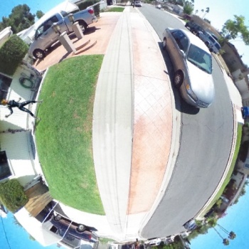
your image in the first post can be remapped in the terminal
the input HAS to be in PPM format , i renamed it for ease of use
-- the Southpole
Code:project stereographic -w 500 -h 500 -long 0 -lat -90 -f 1.ppm > 2.ppm
or the added animation of the girl
Code:project stereographic -w 500 -h 500 -long -72 -lat -2 -f 1.ppm > 3.ppm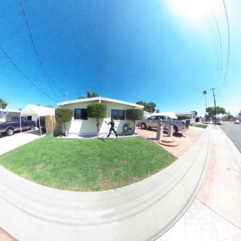


 Reply With Quote