

 Reply With Quote


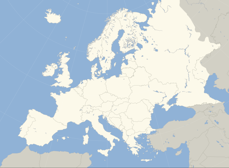
Hi,
The problem with that kind of projection : you cannot base your map on free materials on the net (open street maps and co).
I got the followings but it's not hi-res either.
europe admin.png
Europe_geographycal.jpg
Hope it will help you!


I have been interested in alternate history stuff lately, and I've created a few scenarios would love to map out.
*Problem is, the projection that I love is one like this;*
But I can't find a map that is hi res enough to accurately trace the coasts, and also depicts major rivers and lakes. I need to have Europe, but also Asian Turkey and the Mediterranean coast of Africa covered (to include most of the Ottoman Empire). Everything that includes what I want seems to be a projection that seriously distorts Scandinavia to massive proportions, or cuts off Africa and Turkey.
I don't have a very large reference map folder, so I hope someone has something of this sort.
Hi,
The problem with that kind of projection : you cannot base your map on free materials on the net (open street maps and co).
I got the followings but it's not hi-res either.
europe admin.png
Europe_geographycal.jpg
Hope it will help you!


Take a look at http://www.naturalearthdata.com/]Natural Earth[/url]. They provide a good chunk of public domain spatial data.
You'll need a GIS like QuantumGIS, uDig, or OpenJUMP to view and manipulate it. You can find an introduction here http://www.cartographersguild.com/sh...-for-using-GIS
I just came back from vacation, and this post was very helpful. I downloaded QGIS and a 10m data set from Natural Earth. After wasting a couple of hours playing around with it, I zoomed in on Europe, set the projection to something like what I wanted, and saved a print composition as an image. Now I have a very large, very accurate map in photoshop including everything I wanted. I have Europe including Iceland, as well as North Africa's coast, and Asia as far as Persia. And all the little lakes, rivers, and islands.Originally Posted by Hai-Etlik

With this technique I can maybe go back to my alternate North America I was making long ago, since I can now create a large map that doesn't distort Canada horribly and doesn't exclude many of the islands on the west coast and northern territories.
Thanks!
 Posting Permissions