Results 1 to 7 of 7

Thread: Need advice for photorealist texturing of a satellite view for a world map.

  1. #1

    Help Need advice for photorealist texturing of a satellite view for a world map.

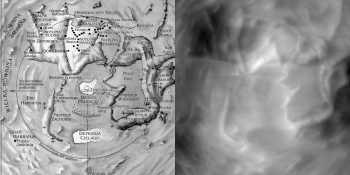
    I have posted a map here few months ago and I am still working on it. I have a paper style map, but I am looking to make a Satellite view of the same map. I am stuck looking for texturing techniques and ideas.

    Here is a low res of the map I made a few months ago:
    Attachment 71594

    Most of the time, I am stuck when trying to make realistic Hills and Sea Floor. And I don't want to make a random cloud pattern, it needs to follow the the landmarks on the map.

    If you have any techniques that could help me, it would be greatly appreciated.

  2. #2

    Default

    So this is more of an artist's approach but you can paint the base textures manually using custom PS or Gimp texure brushes. These are my favorites:
    http://tonyhurst.deviantart.com/art/...et-2-335436332
    http://tonyhurst.deviantart.com/art/...No-1-324890243

    Mountains, etc. are a bit more challenging and someone else is probably more qualified to advise you on that.

    If there's one suggestion I'd make for your map, though, it's that the coastlines are a little too fractal. If you look at a satellite view of Earth you'll see that many real coastlines are quite smooth.

    mercator-projection.jpg

  3. #3
    Banned User
    Join Date
    Jul 2014
    Location
    Traverse City, Michigan, USA
    Posts
    2,547

    Default

    Quote Originally Posted by Malicious-Monkey View Post
    .....
    If there's one suggestion I'd make for your map, though, it's that the coastlines are a little too fractal. If you look at a satellite view of Earth you'll see that many real coastlines are quite smooth.
    Don't confuse the term "fractal" with jagged and irregular. A common mistake and totally incorrect. Fractal has nothing to do with smooth versus jagged. It has to do with shapes repeating at different scales.

    So if I may paraphrase your suggestion, it would be ".... that the coastlines are a little too jagged and irregular."

  4. #4

    Default

    Sorry, you're totally right. Though I meant too many repeating shapes and not enough variation, which can result in the jagged appearance, it doesn't really make sense to say something is more or less fractal.
    Last edited by Malicious-Monkey; 08-03-2015 at 03:15 PM.

  5. #5

    Default

    Thanks for the advice on the coastlines. These brushes will probably help me achieve a natural look, but they don't answer my questions.

  6. #6
    Administrator Redrobes's Avatar
    Join Date
    Dec 2007
    Location
    England
    Posts
    7,245
    Blog Entries
    8

    Default

    I can tell you how I do it but it may not be convenient for you.

    I have a list of sources which are black and white greyscale images. Those kinds of things are like terrain height, depth under sea, wetness, temperature, forest, scrub etc. If you have that kind of information in your map then maybe this will work otherwise you might not be able to use it. Anyway, to continue, I also have a list of textures for stuff like, rock, river, snow, trees, mud, sand, etc.

    You take the greyscale source map and then use it as a look up as to how much of each of the textures to apply. By scaling and then multiplying the texture and adding it in you can build it up from the rock base layer to the topmost like trees.

    Its tedious to do by hand so I use a script for this and you can use something like image magick to do that blending and masking process. I have a big script kind of thing with many layers which I just repeatedly use for everything. I.e. once you have your script set up then you can reuse it over and over. If you change the map then you generate your sources again from it and then run the script to generate the overall map.


    Also, Blender could do this same job with those kinds of input files.

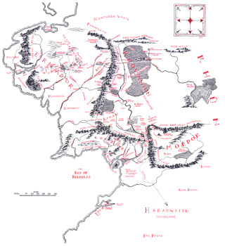
    Edit: Oh yeah, you can also render out the text names and use the same process to apply them too. You can see that on this pic below. Also, you can see in Fangorn that my tree texture is not repeating very well at this scale.

    Last edited by Redrobes; 08-04-2015 at 01:33 PM.

  7. #7
    Guild Expert johnvanvliet's Avatar
    Join Date
    Jul 2012
    Location
    N 42.39 W 83.44
    Posts
    1,091
    Blog Entries
    4

    Default

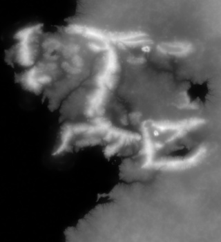
    converting your mountains into something like a radar or lidar would have seen
    will be "fun"

    doable

    there are a lot of guides for wilbur so start with them
    converting one style to another is a bit difficult


    or M.E. like in this post
    http://www.cartographersguild.com/sh...l=1#post271905


    then from the topographic image move into a colored one like the image of the Earth a few posts above
    that takes time


    Araakis and Middle Earth were done using VERY different methods
    from your map in the first post
    i might use something like i did for ME

    fi you want i can go into detail

    only the very basic things have a step 1 then 2 then 3 and so on
    Last edited by johnvanvliet; 08-05-2015 at 06:08 PM.
    --- 90 seconds to Midnight ---
    --------

    --- Penguin power!!! ---


Posting Permissions

  • You may not post new threads
  • You may not post replies
  • You may not post attachments
  • You may not edit your posts
  •