Page 3 of 4 FirstFirst 1234 LastLast
Results 21 to 30 of 31

Thread: World Map (sort of a crossover project with Sapiento...)

  1. #21
    Professional Artist Guild Supporter Wired's Avatar
    Join Date
    Jun 2008
    Posts
    1,664

    Default

    Not much going to happen past this point. Some texturing, most of the labeling, and some color matching, that`s all.

  2. #22
    Professional Artist Guild Supporter Wired's Avatar
    Join Date
    Jun 2008
    Posts
    1,664

    Default

    Snodsy, Josiah; I've tried to take your remarks to heart. A general grungy light/shade layer set to overlay creates some more variance with regards to the terrain and the transitions, and makes the oceans look less dominated by a repeating pattern. As for the pattern, a copied and displaced that one, did some stretching and warping and reduced the opacity of it. Should work better now.

    Also played around with the textures and the coloration of the location symbols; only on Multania for now until the client makes his judgement.

    Rush Howell World Map WIP10small.jpg

  3. #23
    Professional Artist Guild Supporter Wired's Avatar
    Join Date
    Jun 2008
    Posts
    1,664

    Default

    Well, this most certainly is a blast from the past. I haven't heard from the client since June 21, 2016 (this post isn't meant as a complaint; I was handsomely paid for the work I had done on what, up to this point, was my largest commission), and it would be a waste to just have this sit on my harddrive and slowly vanish under a cover of virtual dust. So I've taken to work on this again with the intention of using some of the original designs I had in mind (the locations used will be those I devised ~15 months ago) as well as making some minute changes to adjust the quality (a beach contour and beach sand layer, new coastal layers, a reduced ocean wave layer). This isn't meant to be a complete overhaul, just an update while keeping the workload reasonable.

  4. #24
    Professional Artist Guild Supporter Wired's Avatar
    Join Date
    Jun 2008
    Posts
    1,664

    Default

    I'm currently adding a line art beach contour layer, after which I'll move on to reworking the coastal layers and the ocean. It's a bit more work than I imagined due to the size.

  5. #25
    Professional Artist Guild Supporter Wired's Avatar
    Join Date
    Jun 2008
    Posts
    1,664

    Default

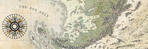
    Okay, the first WIP of the reworked version. Cleaned up the coastal layers, added beach features and actual beaches, added a highlight layer for the hills.

    VRADIKAR upload1.jpg

  6. #26

  7. #27

    Default

    Hey Wired

    Found you over here. (I keep loosing track of what everyone else is up to!)

    That looks great

    There are only two questions in my mind - why are the big trees so pale, and why are the icons on the nameless desert land so identical for the most part, when the ones everywhere else are really different and a lot more interesting to look at?

    Would you consider slimming down that thick cream glow around the labels just a tiny bit?

    EDIT: Ok I lied - that was 3 questions...

  8. #28
    Professional Artist Guild Supporter Wired's Avatar
    Join Date
    Jun 2008
    Posts
    1,664

    Default

    Quote Originally Posted by Mouse View Post
    Hey Wired

    Found you over here. (I keep loosing track of what everyone else is up to!)
    Don't worry, Sue, I wish I had your ability to keep up with all that's happening around here.
    That looks great
    Thank you!
    There are only two questions in my mind - why are the big trees so pale
    They aren't actual trees but are the location symbols for Elven Settlements that I just haven't named those yet (and there's the little issue of there not yet being a legend), just as the interlocked gear are the symbols for Dwarven holds. [Quote]and why are the icons on the nameless desert land so identical for the most part, when the ones everywhere else are really different and a lot more interesting to look at?7quote]You mean the ones in the upper right corner? I just haven't found the time and desire to do much with them. The whole part's ruined and devastated, so I might add some variety to the ruins and a different color scheme lateron.
    Would you consider slimming down that thick cream glow around the labels just a tiny bit?
    Yes, those aren't the final ones (in fact, I believe that if you check an earlier version of the map you'll find the same ones as I just made that layer visible for the upload of the WIP image; most labels don't also quite match the positions of the locales).

  9. #29
    Software Dev/Rep Hai-Etlik's Avatar
    Join Date
    May 2009
    Location
    48° 28′ N 123° 8′ W
    Posts
    1,333
    Blog Entries
    1

    Default

    Probably not what you want to hear so late in but there are a bunch of things about this map that are inconsistent.

    Evidently cold areas at the top and bottom, suggesting this is a cylindrical projection of a significant portion of a globe.

    Evenly space chequed neatline says that this is equidistant cylindrical (or that the coordinate system is not lat long, but I can't think of any other reasonable system that would work.)

    The land does not appear distorted toward the poles the way cylindrical projection should do. (Which would mean it's the land itself that's distorted)

    Compass rose, but the only projection that is bearing preserving at this extent is Mercator, not equidistant cylindrical.

    Scale bar (Assuming you plan to bring it back) indicates that this is distance preserving, but no projection at this extent is distance preserving. Equidistant cylindrical preserves straight north-south distances only.

    The scale itself seems strange. The map seems to span 3600 miles (5800 km) but the pole to pole distance on earth is 20,000 km. So if your planet is about Earth sized, the map only spans to about 25 degrees north/south. To make it reach to say 70 degrees you would need a planet about 0.37 times the radius of Earth. About the size of Mercury. Getting anything like Earthlike conditions on something that small would be very difficult. (Maybe if it were solid Tungsten)

  10. #30
    Professional Artist ThomasR's Avatar
    Join Date
    Nov 2015
    Location
    Angers, France
    Posts
    4,199

    Default

    Quote Originally Posted by Hai-Etlik View Post
    Probably not what you want to hear so late in but there are a bunch of things about this map that are inconsistent.

    Evidently cold areas at the top and bottom, suggesting this is a cylindrical projection of a significant portion of a globe.

    Evenly space chequed neatline says that this is equidistant cylindrical (or that the coordinate system is not lat long, but I can't think of any other reasonable system that would work.)

    The land does not appear distorted toward the poles the way cylindrical projection should do. (Which would mean it's the land itself that's distorted)

    Compass rose, but the only projection that is bearing preserving at this extent is Mercator, not equidistant cylindrical.

    Scale bar (Assuming you plan to bring it back) indicates that this is distance preserving, but no projection at this extent is distance preserving. Equidistant cylindrical preserves straight north-south distances only.

    The scale itself seems strange. The map seems to span 3600 miles (5800 km) but the pole to pole distance on earth is 20,000 km. So if your planet is about Earth sized, the map only spans to about 25 degrees north/south. To make it reach to say 70 degrees you would need a planet about 0.37 times the radius of Earth. About the size of Mercury. Getting anything like Earthlike conditions on something that small would be very difficult. (Maybe if it were solid Tungsten)
    Might be a fantasy world, or a non accurate depiction of said world, or maybe the geography is not that well known by the cartographer (not you Sebastian) ...
    BTW, the new map is less messy (the texture of the ocean was overpowering zoomed out) and the new colors are pretty good, good job

Page 3 of 4 FirstFirst 1234 LastLast

Posting Permissions

  • You may not post new threads
  • You may not post replies
  • You may not post attachments
  • You may not edit your posts
  •