Page 3 of 3 FirstFirst 123
Results 21 to 29 of 29

Thread: 16th Century Styled Eastern Netherlands [Historical]

  1. #21

    Default

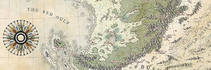
    Well, here's how the watercolor situation resolved itself.

    I went and had the map scanned in high res at a local office supplies store with a large enough scanner.

    I failed to look at the scans closely enough before I then took the maps to get framed.

    When I began to inspect the scan, I realized its settings were calibrated for too high of a contrast, and the color washes were not picked up at all: the scan only showed white areas.

    So I've had to go back and digitally touch up the scan so it reflects the gradiated watercolor washes in a manner close to the physical original.

    All in all, it will do.

    EasternLC-Map-Composite-Watercolors.png
    Current Project: The Low Countries & Their Periphery, c. 1584

    Do you like Renaissance and early modern history? Check out my Facebook page, Renaissance Netherlands with Will Phillips.

  2. #22

    Default

    Oh - and here's a photo of the maps from this weekend's competition where they were awarded the Judge's Choice from a field of almost sixty entrants ranging across all manner of arts, crafts, and areas of research across the medieval and Renaissance eras.

    display.jpg
    Current Project: The Low Countries & Their Periphery, c. 1584

    Do you like Renaissance and early modern history? Check out my Facebook page, Renaissance Netherlands with Will Phillips.

  3. #23
    Guild Expert Facebook Connected Caenwyr's Avatar
    Join Date
    Apr 2012
    Location
    Flanders, Belgium
    Posts
    1,276

    Default

    looking fabulous, Will! I must admit I like the black and white version a little better, the other one is a bit too... vibrant for me. But that's a compliment in itself! It means you managed to draw a black and white map that's actually perfectly clear, and doesn't even need the colours!
    Caenwyr Cartography


    Check out my portfolio!

  4. #24
    Professional Artist ThomasR's Avatar
    Join Date
    Nov 2015
    Location
    Angers, France
    Posts
    4,199

    Default

    The maps are great and teh idea of framing it in old frames is a blast (I've got some in a corner that need refreshing, myself) ! And like Caenwyr, I'm more seduced by the sober one

  5. #25

    Default

    Quote Originally Posted by Caenwyr View Post
    looking fabulous, Will! I must admit I like the black and white version a little better, the other one is a bit too... vibrant for me. But that's a compliment in itself! It means you managed to draw a black and white map that's actually perfectly clear, and doesn't even need the colours!
    I think I'd go one step further than you in the pickiness stakes and say I'd love to see a version with the black and white map but with the colour border. Is that what they call trying to have your cake and eat it though?

    Either way both versions have turned out great!

  6. #26

    Default

    That is awesome to hear Will. Congratulations
    No small feat considering the number of entrants and all the varied styles of work. Bravo.
    I have always had issue with how loud the colors were in older maps and the colors they would combine, so they have never been favorites.
    But.. i have always loved the non-colored maps for their clean lines and delicate ink work.
    You definitely achieved that. The color is good, just not my taste. But does look good for the period style. nods.

    edit - drat. Must spread rep...

  7. #27
    Guild Expert DanielHasenbos's Avatar
    Join Date
    Mar 2015
    Location
    The Netherlands
    Posts
    1,623

    Default

    Absolutely Amazing Will! Also congratulations on winning the award! I like both versions of the map very much, though I'm tempted toward the black and white one. That's probably because I generally like subtle and subdued tones better. Anyways, great work!

  8. #28

    Default

    I'm with you guys - I actually like just the inks more.

    When I was messing around with color palettes, an all-green approach to the land looked pretty nice. However, my goal was to emulate the work of the "golden age" cartographers as closely as I could, and that meant the multi-color approach I ended up with.

    Even though the modern watercolors I used are a little more intense than the plant-based pigments that were used historically, the colors back then were still very bright.

    I jokingly call it "Skittles colors" because the map ended up so bright, but hey - if I was some wealthy merchant or nobleman 400 years ago, this is apparently what I'd like.
    Current Project: The Low Countries & Their Periphery, c. 1584

    Do you like Renaissance and early modern history? Check out my Facebook page, Renaissance Netherlands with Will Phillips.

  9. #29
    Administrator ChickPea's Avatar
    Join Date
    Jan 2015
    Location
    Sunny Scotland
    Posts
    6,884

    Default

    Your pics look awesome! Thanks for sharing.

    I kinda like both versions. The colours are pretty bright, but as you say, that is true to the era. They had Blaeu's atlas on display in Edinburgh last year, and I was amazed by how vivid the colours were. I guess I thought a centuries-old book would have faded somewhat, but nope. Even my photos didn't do it justice. So, yeah, you get a thumbs up for the colours from me!
    "We are the music makers, and we are the dreamers of dreams"

Page 3 of 3 FirstFirst 123

Posting Permissions

  • You may not post new threads
  • You may not post replies
  • You may not post attachments
  • You may not edit your posts
  •