Results 1 to 2 of 2

Thread: Steampunk Mars game map

  1. #1

    Default Steampunk Mars game map

    On the Paradox Interactive forum, I recently ran a strategy game I called the Scramble for Mars. It was a set on an inhabited Mars being colonized by 19th century powers, with a distinct steampunk theme. The key feature was the map, which I was never satisfied with.

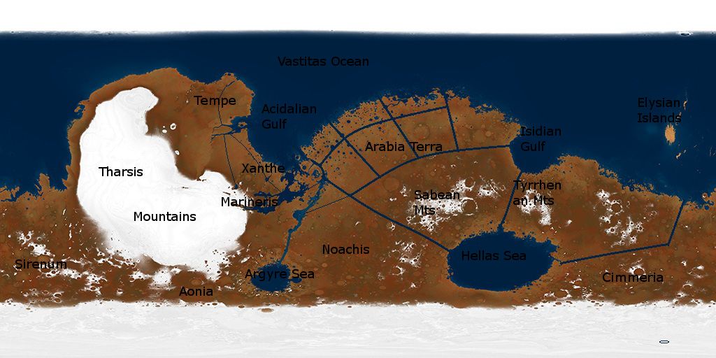
    I essentially took an image I found on DeviantArt, one of several awesome ones by I guy called Ittiz (I made sure to credit him, but don't recall if I got his permission):

    Ancient Mars Map by ~Ittiz on deviantART

    and adding canals clumsily via GIMP.


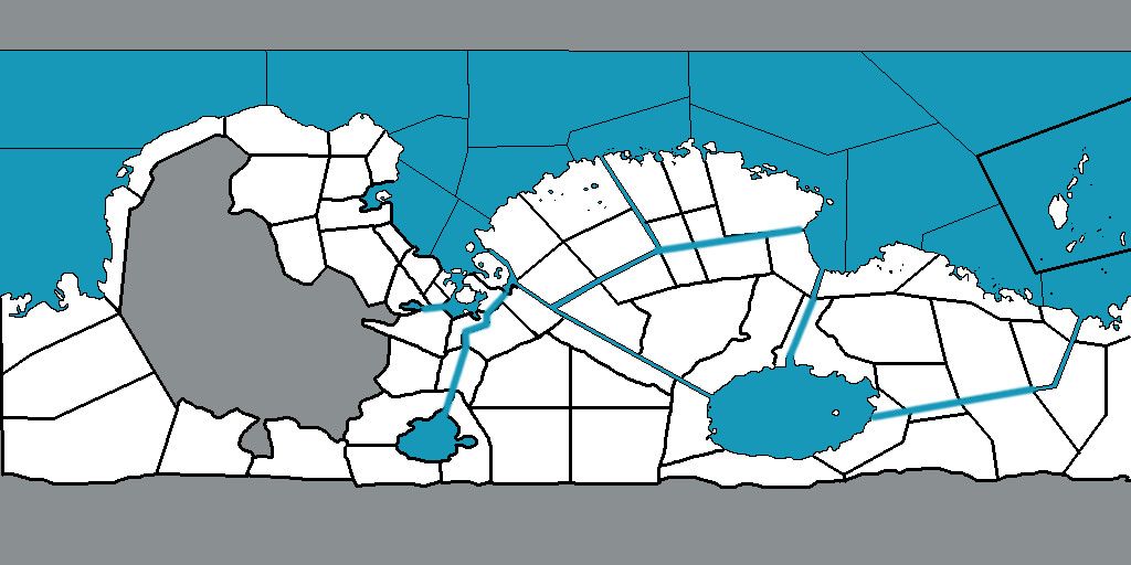
    A collaborator helped draw these province boundaries:


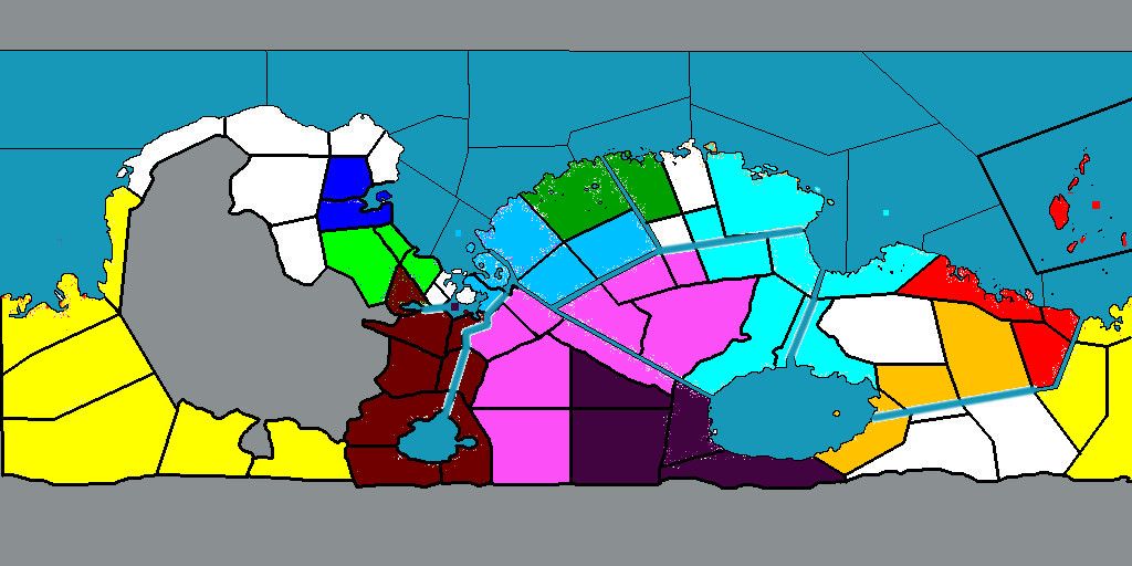
    It worked well enough, using colors to represent players. Here's what Mars looked like on the last turn, 1884:


    Nymeria: cyan, Italian corporation
    Nova Lusitania: turqouise, Portugese Royal Colony,
    Shin Kyoto: Red, Japanese Imperial Colony
    Neo Theassalia: Dark Purple, Greek Royal Colony
    New Vermont: neon green, British Imperial Colony
    New Aquitaine: Dark Blue, French Republic Colony
    Ukrainian Martian Resistance: Yellow, Ukrainian rebel base
    Deutsche Marsreich: goldish-orange, German Imperial Colony
    Yeni Baghdad: Dark Red, Ottoman Imperial Colony
    Land of Red Snow: Pinkish Purple, Tibetan Bhuddist monestary-kingdom
    Republic of Mars: Dark Green. Independant Republic

    Anyways, I'm thinking of taking another shot at this game. Among the many things I'd like to do better is the map. Rather than butchering Ittiz's good work again, I'd like to take my time working from a public domain elevation map, then fill in the oceans and seas, and add a more sensible system of canals. I'll have a smaller Tharsis ice cap, with an oval of canals surrounding it as though to catch seasonal meltwater and distribute it to the desert interior. Then populate it with the native martian cities and draw more sensible province boundaries.

    Edit: If anyone has some suggestions that would make it seem more steampunk-ish, or more like a real life 1880s-90s map of a frontier/colonial region, without hurting readability, that would be helpfull.
    Last edited by Deaghaidh; 05-11-2013 at 07:14 PM.

  2. #2
    Guild Expert Guild Supporter Lingon's Avatar
    Join Date
    Dec 2012
    Location
    Sweden
    Posts
    1,212

    Default

    Found your thread, Deaghaidh

    Wikimedia Commons has an amazing collection of old maps, sorted by year, which are great for inspiration and reference. Here are their 19th century maps:
    Category:Maps made in the 19th century - Wikimedia Commons

    For "pure" steampunk I guess it's 1880-90 you should look at in particular, as you said, but earlier maps could be useful as well.

Posting Permissions

  • You may not post new threads
  • You may not post replies
  • You may not post attachments
  • You may not edit your posts
  •